Real-Time Satellite Data
Real-Time Satellite Data
Introducing an immersive and interactive map component within our platform, offering users an unparalleled experience with real-time satellite data for a specific carbon offset project. This cutting-edge feature allows users to explore time-lapses and dynamic visualizations, gaining valuable insights into the progress and impact of the carbon offset initiative. The interactive map provides a detailed overview, allowing users to navigate and zoom in on specific regions, observe tree covers, and engage with comprehensive data overlays. Harness the power of real-time information to make informed decisions and track the environmental impact of our carbon offset projects. Elevate your user experience with this innovative map component, designed to enhance understanding and transparency in the pursuit of sustainability. Here is a sneak peak:
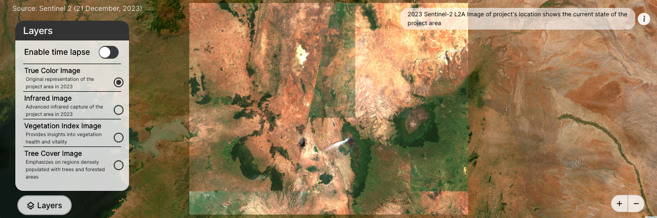
The Satellite Data endpoint provides a dynamic set of visual resources for enhanced environmental monitoring. The returned data, indicated by a "status" of true, includes an array of objects, each representing a distinct satellite imagery tag and its corresponding link. The available imagery types cover a broad spectrum, including "True Color Image," "Infrared Image," "Vegetation Index Image," and "Tree Cover Image," each accessible via provided links. Additionally, the endpoint offers timelapse videos for various tags, such as "True Color Timelapse Video," "Infrared Timelapse," "Vegetation Index Timelapse," and "Tree Cover Timelapse Video." These resources can be seamlessly integrated into applications or platforms, allowing users to visually explore and analyze the project area's environmental dynamics. The dynamic nature of these satellite visuals facilitates a more comprehensive understanding of the project's ecological context, offering stakeholders valuable insights for informed decision-making.
You won't be able to fetch any data without an API key. Generate one here.
Make your request
const apiEndpoint = 'https://data.tryatmos.com/atmos/get_satellite_data/?project_id=VCS2338';

// Fetch request
fetch(apiEndpoint, {
  method: 'GET', // or 'POST', 'PUT', etc.
  const headers = {
    "x-api-key": "<your api key>",
    "Content-Type": "application/json",
  };
  // You can include a request body for methods like POST or PUT
  // body: JSON.stringify({ key: 'value' }),
})
  .then(response => {
    if (!response.ok) {
      throw new Error(`HTTP error! Status: ${response.status}`);
    }
    return response.json();
  })
  .then(data => {
    // Handle the response data
    console.log(data);
  })
  .catch(error => {
    // Handle errors
    console.error('Error:', error);
  });